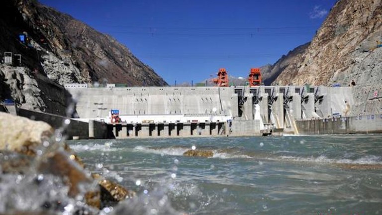
(TibetanReview.net, Nov09’20) – China has since 2010 planned hydropower projects over occupied Tibet’s Yarlung Tsangpo river, known in India as the Brahmaputra, to harness energy in the middle reaches of the river amid protests from India. Now those protests may grow more intense as Beijing has signalled that it is shifting its attention to the lower reaches of the waterway, moving closer to India, reported the scmp.com Nov 8.
The river runs for about 1,625km through southeast Tibet before it flows into the Indian state of Arunachal Pradesh, itself claimed by China as a part of occupied Tibet, and enters Bangladesh.
Tibet is a key area for power generation in China, with its rivers estimated to have about a quarter of the PRC’s total potential capacity, the report cited Chinese government estimates as saying.
In the previous two five-year plans China set targets for “hydroelectric facilities at the middle basin”, which is close to the Line of Actual Control (LAC) – a 3,488km unmarked de facto boundary between occupied Tibet and India that has seen decades of claims and counterclaims.
At least 11 hydroelectric projects along the river had been operating or been planned by China over the past decade. The largest among the three known to be in operation is Zangmu, which started to fully operate since 2015. Hydropower stations in Bayu, Jiexi, Langta, Dakpa, Nang, Demo, Namcha and Metok towns in Tibet are either on the drawing board or under construction, the report noted.
What is particularly worrying is that China has also planned a dam on the lower reaches that would be at least double the size of Three Gorges Dam. However, feasibility of the project was still being examined, the report noted.
“These [dam projects] have instigated worries in India as Chinese construction of dams close to the LAC, mixed with the India-China boundary disputes, assumes to be carrying strategic intents while creating strategic divide between India and its Himalayan rivers,” the report quoted Jagannath Panda, a research fellow at New Delhi’s Manohar Parrikar Institute for Defence Studies and Analyses, as saying.
He has also noted the Chinese foreign ministry’s recent claim that Beijing had never recognised Arunachal Pradesh as part of India as an alarming sign that Beijing might use the dams and other water infrastructure as “a strategic tool to expand its control over the region”.
Apart from the strategic implications, there are worries in downstream countries India and Bangladesh about the environmental impact of more dams and river diversions. Both had been worried that China’s major interventions over the waterway will affect the ecosystem as well as the river flow downstreams, the report noted.


