


(TibetanReview.net, May17’20) – Google Earth and Map had both placed Mt Everest in Chinese ruled Tibet while China had also been claiming the world highest peak as its own, complained an english.khabarhub.com report from Nepal May 16.
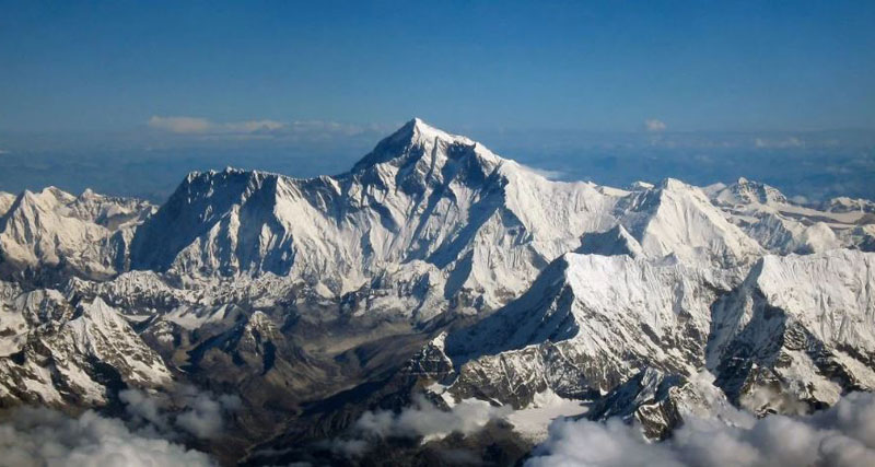
“When ‘Mt Everest’ was searched in Google Earth on May 16, the site returned with the result that Mt. Everest is in Tibet, China. The Earth shows Mt Everest in 27.99N, 86.92 E which is clearly located in China,” the report said.
The report said Google Map also showed Mt Everest was in Tingri County, Shigatse, Tibet, China.
The report noted that according to a 1960 Border Resolution Agreement, China and Nepal had decided that Mt Everest would be divided thus: the Southern slope would belong to Nepal and the Northern slope to Tibet, which China claims as a part of its territory.
It was also stated to have been decided that the China-Nepal border would pass through the summit of Mt Everest.
But now that Beijing wants to use the highest peak in the world for its 5G network and doesn’t even recognize the fact that Mt Everest lies in Nepal, the report complained.
It noted that the China Global Television Network (CGTN) had tweeted on May 2 that the world’s highest peak, Mt Everest, was in China.
The report acknowledged that following protests by social media users, it had deleted its previous tweet, with a replacement, saying: “An extraordinary sun halo was spotted on May 1 in the skies over Mount Qomolangma, the world’s highest peak, located on the China-Nepal border”.


